Pets welcome
Pets must be kept on a leash.
Parking
Parking area at Muuraismäentie 725, Höytiä
Winter maintenance
No winter maintenance
Starting point/end point
The address of the car park is Muuraismäentie 725. The route is marked with blue paint markings on trees.
Coordinates
N 6923652, E 415095
Route length
The trail is 1.3 km long and you should allow at least 1 hour to complete the trail. The trail has some differences in elevation. There are stairs in the steepest places to make the climb easier.
Structures
There are information boards along the trail providing facts about the local habitat.
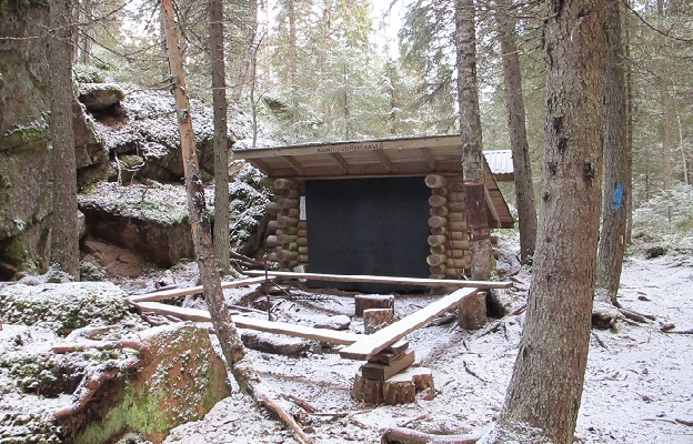
Lapp hut or camp fire
There is a lean-to shelter at the bottom of the Konttivuori cliffs, with a campfire place and dry toilet.
Target´s maintenance
Municipality of Uurainen