Pets welcome
Pets must be kept on a leash.
Location and arrival
Nyrölä trail is easiest to reach with a car. Local bus Linkki operates during week days. Check the schedules: https://jyvaskyla.digitransit.fi/
Parking
Small parking are at Sikomäentie 700. If the area is full, parking at Nyrölä House at Jatkolantie 11, Nyrölä. Roadside parking is prohibited.
Winter maintenance
No winter maintenance.
Starting point/end point
The starting point and car park are on Sikomäentie, near Nyrölä school.
Coordinates
ETRS-TM35FIN N 6915543, E 421544.
Route length
3,6 km. Allow 2–3 hours to complete the trail.
Structures
Wooden boardwalks.
Lapp hut or camp fire
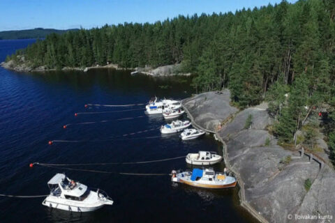
The island has a double lean-to shelter, fireplace, a cooker, a dry toilet and a boat jetty. The shelter sleeps 10 people. There is another lean-to shelter near the bog before the cable ferry.
Target´s maintenance
Nyrölä Village Association